
“`json
{
“title”: “Never Get Lost Again: How to Avoid Common Pitfalls of the Japanese Address System”
}
“`
Never Get Lost Again: How to Avoid Common Pitfalls of the Japanese Address System 📍
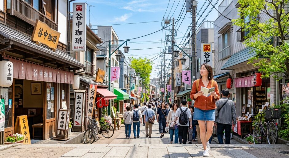
Picture this: You’ve just arrived in Tokyo. You have the address of a tiny, legendary ramen shop tucked away in a side street. You open Google Maps, follow the blue dot, and… you’re standing in front of a laundromat. 🧺 The map says you’ve arrived, but the ramen is nowhere to be seen.
Welcome to the beautiful, logical, yet utterly bewildering world of the Japanese address system. Unlike the Western world, where we rely on street names, Japan uses a system based on areas and blocks. If you don’t know the “rules of the game,” even a 5-minute walk can turn into a 30-minute maze. But don’t worry—Japan Hacks is here to turn you into a navigation pro! 🌸
📊 Japan Hacks Dashboard: Navigation Difficulty
System Complexity:
Quick Verdict: Most streets in Japan don’t have names. Addresses are hierarchical (Prefecture > City > Ward > District > Block > Building). It’s essentially a giant game of “zooming in” on a map.
🗺️ The Core Concept: Areas, Not Streets
In London, New York, or Paris, you look for a street name and then a house number that usually goes in chronological order (2, 4, 6…). In Japan, the street is just the space between the blocks. The blocks are what matter.
A typical Japanese address looks like this:
Tokyo-to, Shinjuku-ku, Nishishinjuku, 2-chome, 8-ban, 1-go.
| Part | Meaning | Analogy |
|---|---|---|
| Tokyo-to | Prefecture | State/Province |
| Shinjuku-ku | Ward/City | Borough |
| Nishishinjuku | District Name | Neighborhood |
| 2-chome | District Subdivision | Small Sector |
| 8-ban | Block Number | The specific block |
| 1-go | Building Number | House/Door number |
⚠️ Pitfall #1: The “Chronological” Chaos
Here is the biggest trap for travelers: Buildings are often numbered by the date they were built, not their physical order on the block.
In older neighborhoods, Building #1 might be right next to Building #15 because they were built 20 years apart. This is why your GPS might show you “arriving” at a location, but you’re actually staring at the back of a building or a small alleyway you didn’t see.
💡 Pro-Tip: Look for the blue plates! On the corner of most buildings or on utility poles, you’ll see small blue or green metal plates with numbers like “12-5”. The first number is the Ban (block) and the second is the Go (building). If you find these, you’re on the right track!
🏢 Pitfall #2: The Missing Building Name
In Japan, the building name is often more important than the number. Many smaller businesses are located on the 4th floor of a building that looks like a regular apartment complex. If your address includes a name like “Sunrise Mansion 4F,” ignore the numbers for a second and start looking for the building sign (usually in Katakana or English near the entrance).
🚨 Real-World Scenario: The Kyoto “Grid” Exception
💡 E-E-A-T Insight: The Kyoto Navigation Hack
In the manufacturing district of Kyoto, many streets do have names because the city was built on a Chinese-style grid. However, even then, locals use “Agaru” (go up/north) or “Sagaru” (go down/south) from a specific intersection. If you are looking for a boutique in Gion, don’t just search the address; search for the nearest intersection. In our experience, telling a taxi driver the intersection (e.g., “Shijo-Kawaramachi”) is 10x faster than giving a numbered address.
Japanese Word of the Day
住所 (Jūsho)
Pronounced: Joo-sho
Meaning: Address.
Use it: “Jusho wa koko desu ka?” (Is the address here?)
🏮 Pitfall #3: Google Maps “Teleportation”
Because Japanese buildings are so densely packed, Google Maps sometimes gets confused by multi-level structures or narrow roji (alleys). In places like Golden Gai in Shinjuku, the map might show you are on top of the bar, but the entrance is actually in a different alleyway entirely.
🚩 Manner Alert: Don’t Block the Flow!
If you get lost and need to check your phone, step to the side of the sidewalk. In busy cities like Osaka or Tokyo, stopping abruptly in the middle of the pavement is considered rude and can cause a pedestrian “traffic jam.” Also, avoid pointing your camera directly into private residences while trying to find a building number!
🚀 3 Pro-Hacks to Never Get Lost
- The Utility Pole Secret: Almost every utility pole in a residential area has a small town-map or the specific block number (e.g., 2-14) written on it. Look up!
- The Convenience Store Landmark: If you are meeting someone, never use an address. Use a 7-Eleven, Lawson, or FamilyMart. There is one on every corner, and they are the “lighthouses” of Japanese navigation.
- Pin the Entrance: When you finally find that hidden cafe, “drop a pin” on your map exactly at the door, not just the general building. You’ll thank yourself next time you visit.
🤔 Frequently Asked Questions
Q: Why don’t Japanese streets have names?
A: Historically, Japanese urban planning focused on the land within blocks rather than the paths between them. It’s a “space-centric” rather than “line-centric” philosophy.
Q: Is there any app better than Google Maps for Japan?
A: Yahoo! Transit (Norikae Annai) is excellent for trains, but for walking, Google Maps is still king, provided you know how to read the building names as mentioned above.
Mastering the Japanese address system is like learning a secret code. Once you stop looking for street signs and start looking for block numbers and landmarks, the city opens up to you in a whole new way. You’ll find those hidden bars, the 100-year-old stationery shops, and the best ramen of your life—without the stress of the “blue dot” letdown.